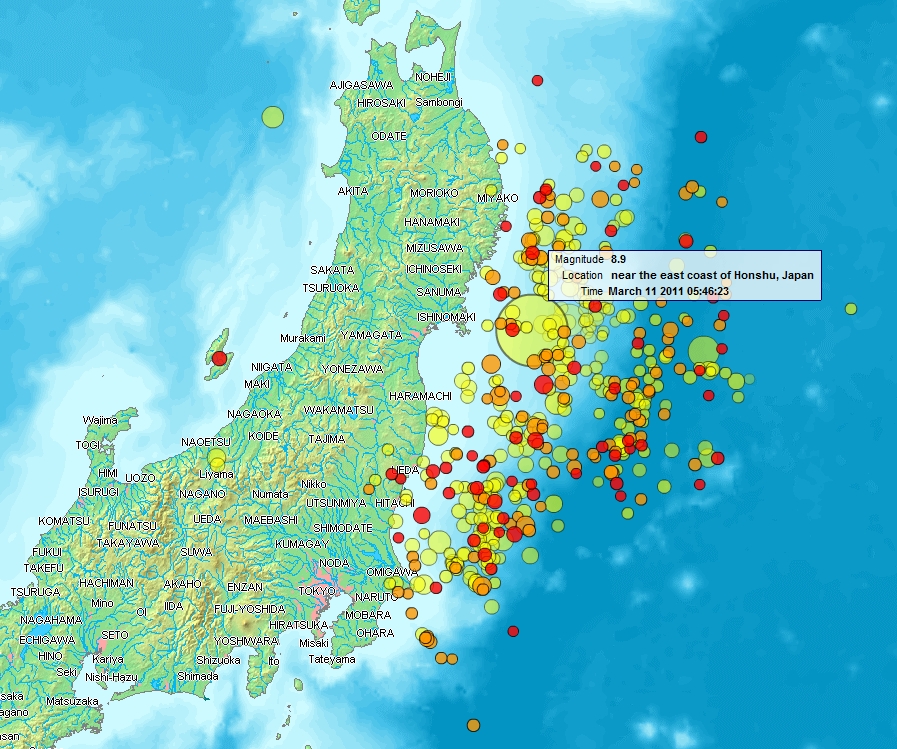
Map of Sendai Earthquake 2011
Forfatter/Opretter:
www2.demis.nl, Uploader User:Heinz-Josef Lücking
Kredit:
Shortlink:
kilde:
størrelse:
897 x 749 Pixel (620525 Bytes)
beskrivelse:
Map of the Sendai Earthquake 2011 and aftershocks until March 14, 2011 at 11:20. The size of the circles is a function of magnitude, and the color indicates the date: light green: March 11; yellow: March 12; orange: March 13; red: March 14.
Licens:
Public domain
Kommentar på licensen:
Public domain according to http://www2.demis.nl
Yderligere oplysninger om licens til billedet kan findes her. Sidste ændring: Wed, 03 Apr 2024 18:24:28 GMT