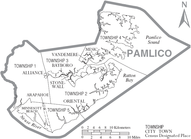
Map of Pamlico County North Carolina With Municipal and Township Labels
Forfatter/Opretter:
US Census, Ruhrfisch
Kredit:
taken from US Census website [1] and modified by User:Ruhrfisch
Shortlink:
kilde:
størrelse:
748 x 543 Pixel (64271 Bytes)
beskrivelse:
Map of Pamlico County, North Carolina, United States with township and municipal boundaries
Licens:
Public domain
Kommentar på licensen:
US Census / US Government work is public domain, my modifications licensed under the GNU Free Documentation License
Yderligere oplysninger om licens til billedet kan findes her. Sidste ændring: Sat, 13 Aug 2022 17:04:51 GMT