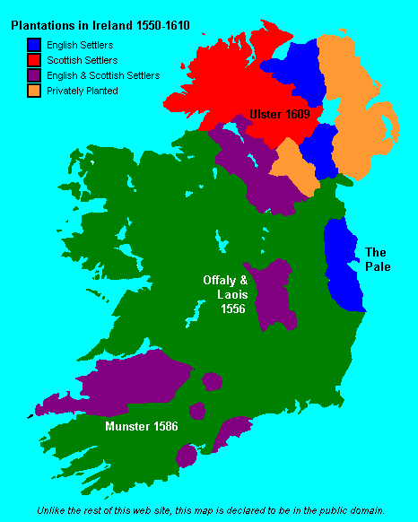
Map of Ireland in 1609

Forfatter/Opretter:
www.wesleyjohnston.com
Shortlink:
kilde:
størrelse:
466 x 582 Pixel (10735 Bytes)
beskrivelse:
Map of Ireland in 1609 showing the major Plantations of Ireland
Licens:
Public domain
Kommentar på licensen:
PD, see image
Yderligere oplysninger om licens til billedet kan findes her. Sidste ændring: Mon, 11 Mar 2024 07:59:19 GMT