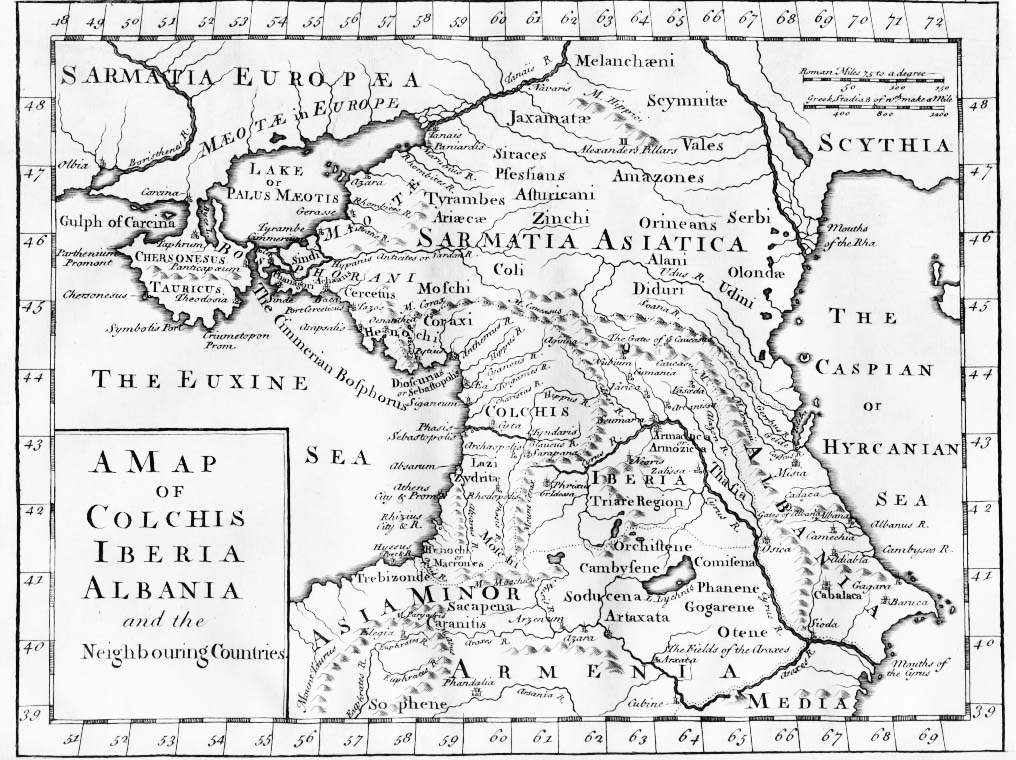
Map of Colchis, Iberia, Albania, and the neighbouring countries ca 1770
Forfatter/Opretter:
last upload en:User:AnonMoos
Kredit:
- Original uploaded to en.wikipedia: en:Image:1729.jpg
Shortlink:
kilde:
størrelse:
1016 x 760 Pixel (198173 Bytes)
beskrivelse:
"A Map of Colchis, Iberia, Albania, and the neighbouring countries". A map of the Caucasus / Crimea (Chersonesus Tauricus)/ southern Russia region during classical antiquity (the ancient period). Note that the "Albania" referred to was on the Caspian Sea (not the modern Albania in the Balkans). Copper-engraved map, no publisher or date, London, ca 1770 (or 1729?).
Licens:
Public domain
Yderligere oplysninger om licens til billedet kan findes her. Sidste ændring: Tue, 24 Jan 2023 07:20:55 GMT