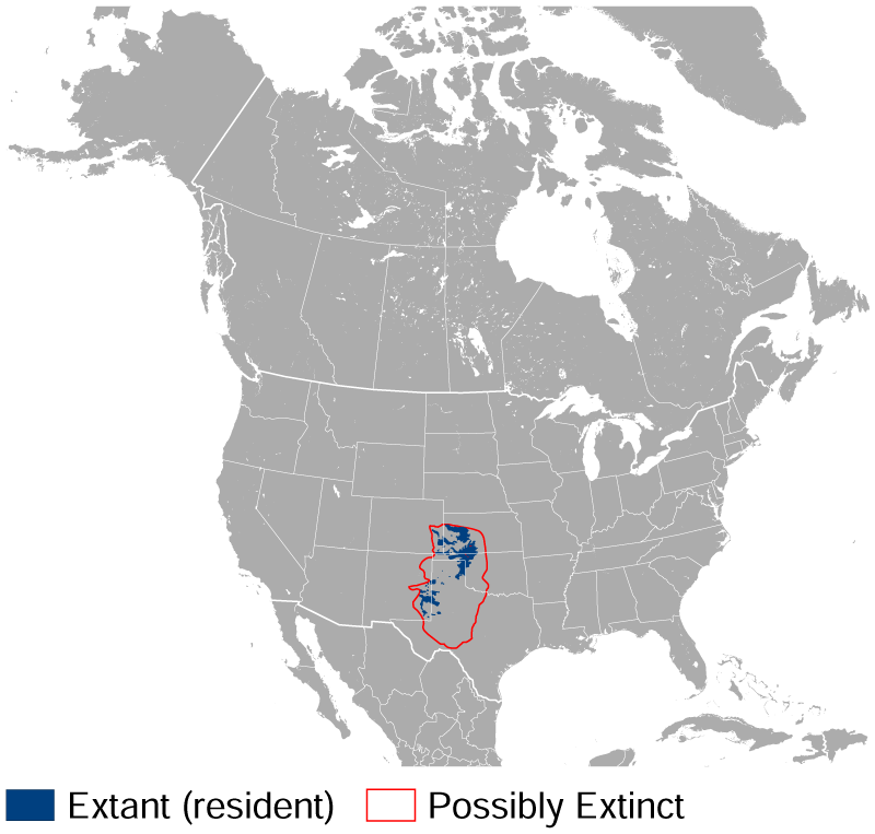
Lesser Prairie Chicken Tympanuchus pallidicinctus distribution map
and the IUCN Red List spatial data, CC BY-SA 4.0
Forfatter/Opretter:
Darekk2 using the IUCN Red List spatial data
Shortlink:
kilde:
størrelse:
800 x 763 Pixel (127445 Bytes)
beskrivelse:
Geographical distribution of the Lesser Prairie Chicken Tympanuchus pallidicinctus.
The map was created using the Generic Mapping Tools, GMT, version 5.1.2.
The map was created using the Generic Mapping Tools, GMT, version 5.1.2.
Licens:
Licensbetingelser:
Creative Commons Attribution-Share Alike 4.0
Yderligere oplysninger om licens til billedet kan findes her. Sidste ændring: Wed, 27 Mar 2024 16:33:08 GMT