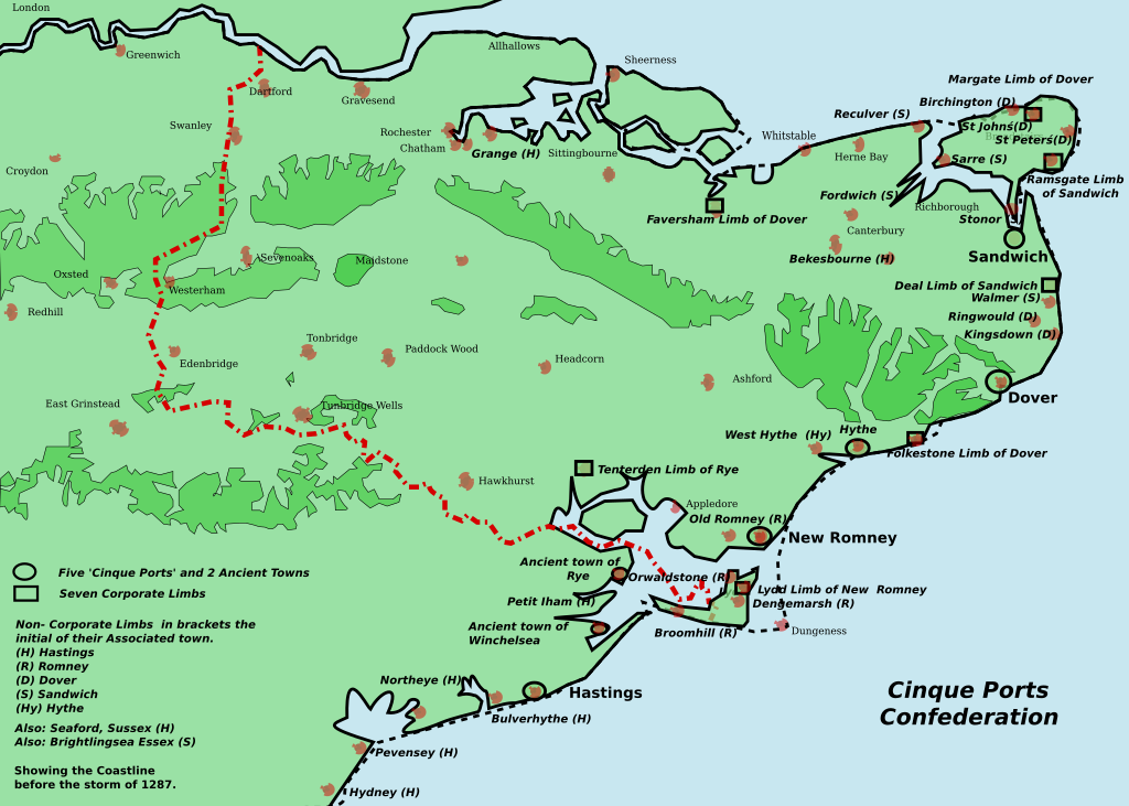
Kent Cinque Ports
Forfatter/Opretter:
Attribution:
Billedet er tagget "Attribution Required", men der blev ikke angivet nogen tilskrivningsoplysninger. Attributionsparameteren blev sandsynligvis udeladt ved brug af MediaWiki-skabelonen til CC-BY-licenserne. Forfattere og ophavsmænd finder et eksempel på korrekt brug af eksempel her. her.
Kredit:
Eget arbejde
Shortlink:
kilde:
størrelse:
1700 x 1212 Pixel (166524 Bytes)
beskrivelse:
This ia a map of the Cinque Ports in Kent and Sussex. All seven of them and their 7 limbs and many of the associated limbs. In 1287, the storm caused the silting up of the channel of the River Rother. The map was inspired by Jessop, Kent History Illustrated- please contact me to inform me of omissions and errors.
Licens:
Licensbetingelser:
Creative Commons Attribution 2.5
Yderligere oplysninger om licens til billedet kan findes her. Sidste ændring: Tue, 24 Oct 2023 22:37:50 GMT
