IrishSeaReliefMap
Forfatter/Opretter:
Attribution:
Billedet er tagget "Attribution Required", men der blev ikke angivet nogen tilskrivningsoplysninger. Attributionsparameteren blev sandsynligvis udeladt ved brug af MediaWiki-skabelonen til CC-BY-licenserne. Forfattere og ophavsmænd finder et eksempel på korrekt brug af eksempel her. her.
Kredit:
old map: http://www.vindaloo.uklinux.net/jjg/code/tmutils.html-> new map: Maps for Free and Eget arbejde
Shortlink:
kilde:
størrelse:
1043 x 1507 Pixel (2250479 Bytes)
beskrivelse:
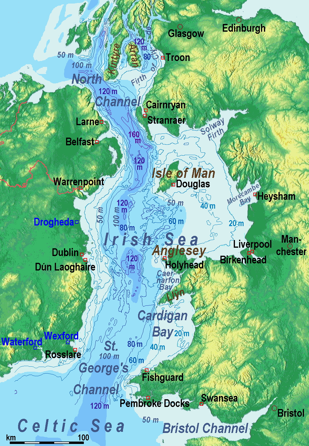
A map of the en:Irish Sea. Major ports shown with red marks. freight-only ports in blue.
The old map with this lemma had significant mistakes of the bathymetry.
Licens:
Kommentar på licensen:
old map: from http://www.vindaloo.uklinux.net/jjg/code/tmutils.html. Released to public domain by creator.
Licensbetingelser:
Creative Commons Attribution-Share Alike 3.0
Yderligere oplysninger om licens til billedet kan findes her. Sidste ændring: Fri, 12 Apr 2024 00:07:44 GMT