Hurricane Katrina August 28 2005 NASA
Forfatter/Opretter:
Jeff Schmaltz, MODIS Rapid Response Team, NASA/GSFC
Shortlink:
kilde:
størrelse:
6200 x 8000 Pixel (9956915 Bytes)
beskrivelse:
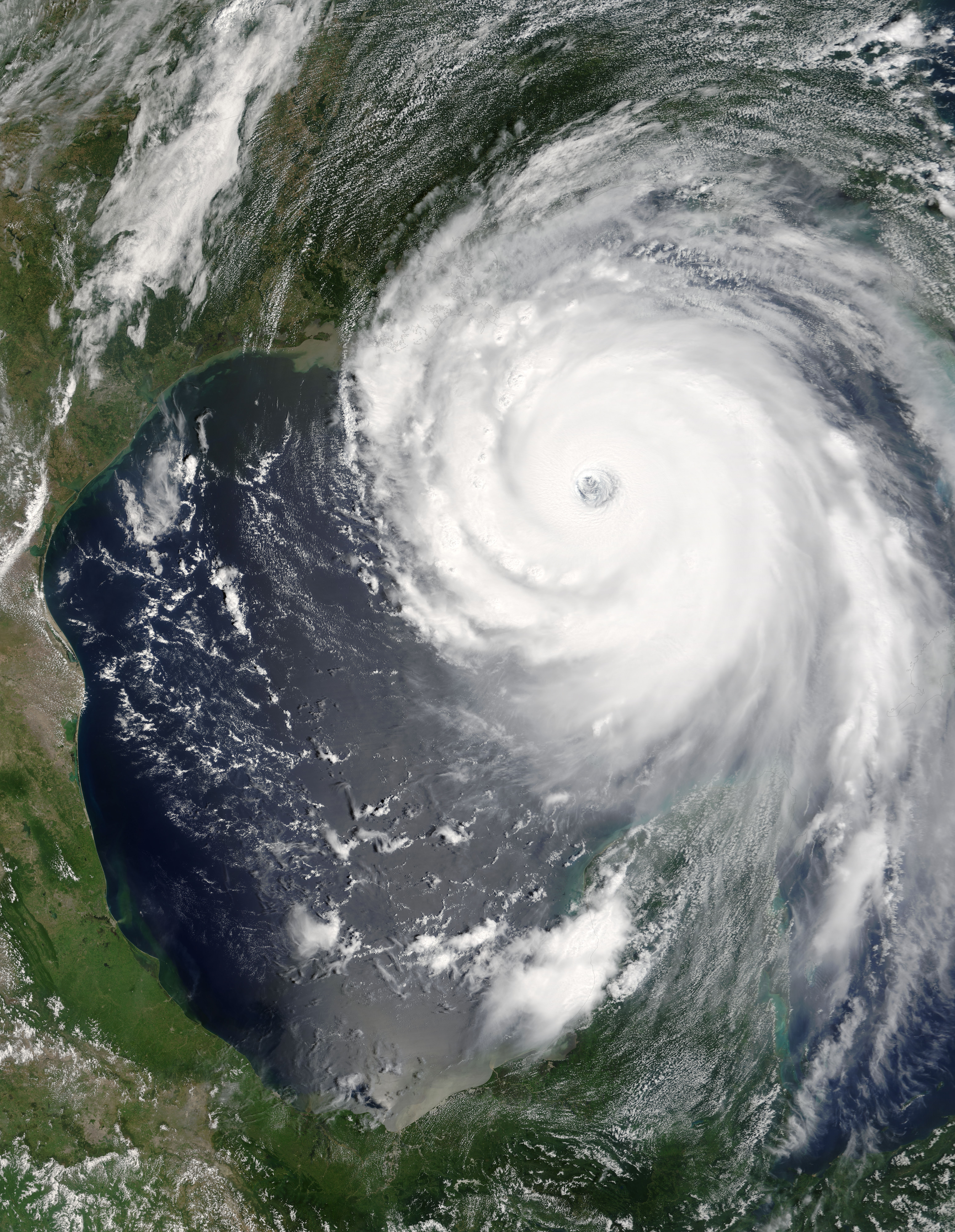
“Katrina is comparable in intensity to Hurricane Camille of 1969, only larger,” warned the National Hurricane Center on Sunday, August 28, 2005. By this time, Hurricane Katrina was set to become one of the most powerful storms to strike the United States, with winds of 257 kilometers per hour (160 miles per hour) and stronger gusts. The air pressure, another indicator of hurricane strength, at the center of this Category 5 storm measured 902 millibars, the fourth lowest air pressure on record for an Atlantic storm. The lower the air pressure, the more powerful the storm.
Two hours after the National Hurricane Center issued their warning, the Moderate Resolution Imaging Spectroradiometer (MODIS) captured this image from NASA’s Terra satellite at 1:00 p.m. Eastern Daylight Savings Time. The massive storm covers much of the Gulf of Mexico, spanning from the U.S. coast to the Yucatan Peninsula.
Licens:
Public domain
Kommentar på licensen:
| Denne fil er i offentligt domæne i USA fordi den udelukkende er skabt af NASA. NASAs ophavsretspolitik erklærer at materiale udgivet af NASA ikke er omfattet af ophavsret medmindre andet er nævnt. (Se også Template:PD-USGov, NASAs ophavsretspolitik eller JPLs politik for brug af billeder.) | ||
 |
Advarsler:
|
Yderligere oplysninger om licens til billedet kan findes her. Sidste ændring: Wed, 03 Apr 2024 11:01:34 GMT