Hawai'i
Forfatter/Opretter:
Earth Sciences and Image Analysis, NASA-Johnson Space Center
Shortlink:
kilde:
størrelse:
5304 x 5250 Pixel (9404757 Bytes)
beskrivelse:
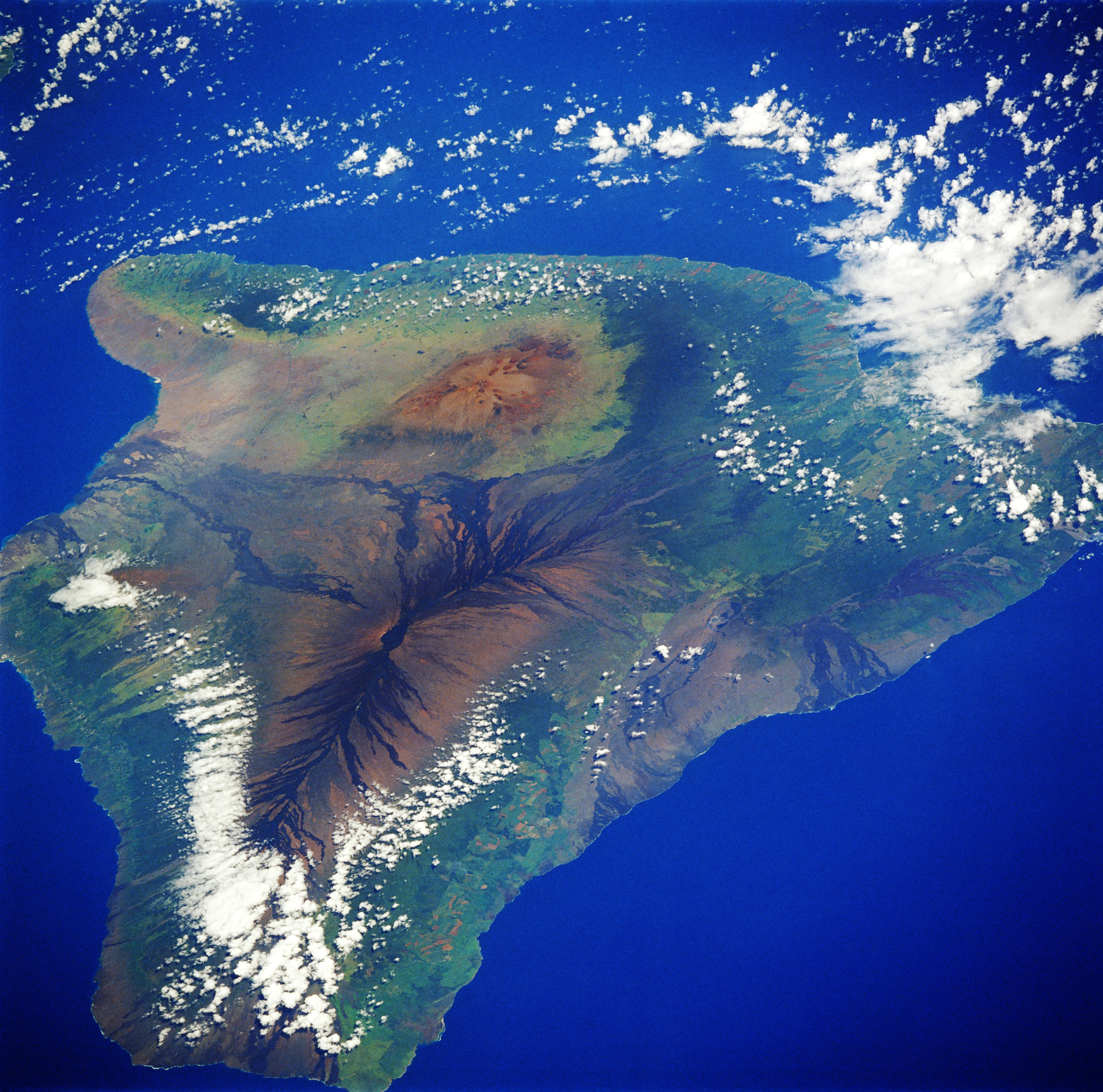
Satellite picture of the island of Hawai'i
- Hawaii, the archipelago’s youngest and largest island, is featured in this low-oblique, north-looking photograph. Apparent are the three main volcanoes that have created the big island—Mauna Loa [13 679 feet (4169 meters)], the easiest to recognize with its rift zone and dark, riblike basalt lava flows that radiate outward from the higher elevations; brownish-looking Mauna Kea, slightly taller at 13 796 feet (4205 meters), but lacking the dramatic appearance of Mauna Loa; and Kilauea near the south-eastern coast. The multiple craters of Kilauea [4078 feet (1243 meters)] are not easily discernible in this photograph. Kilauea and Mauna Loa continue to be two of the world’s most active shield volcanoes as they periodically add new acreage to the big island.
Licens:
Public domain
Kommentar på licensen:
Yderligere oplysninger om licens til billedet kan findes her. Sidste ændring: Mon, 05 Feb 2024 15:27:23 GMT