Hanover1720
Forfatter/Opretter:
Kredit:
Eget arbejde
Based on Map 1, page 378, Hatton, Ragnhild (1978) George I: Elector and King, Cambridge, MA: Harvard University Press ISBN: 0-674-34935-0.
Shortlink:
kilde:
størrelse:
2500 x 2120 Pixel (549916 Bytes)
beskrivelse:
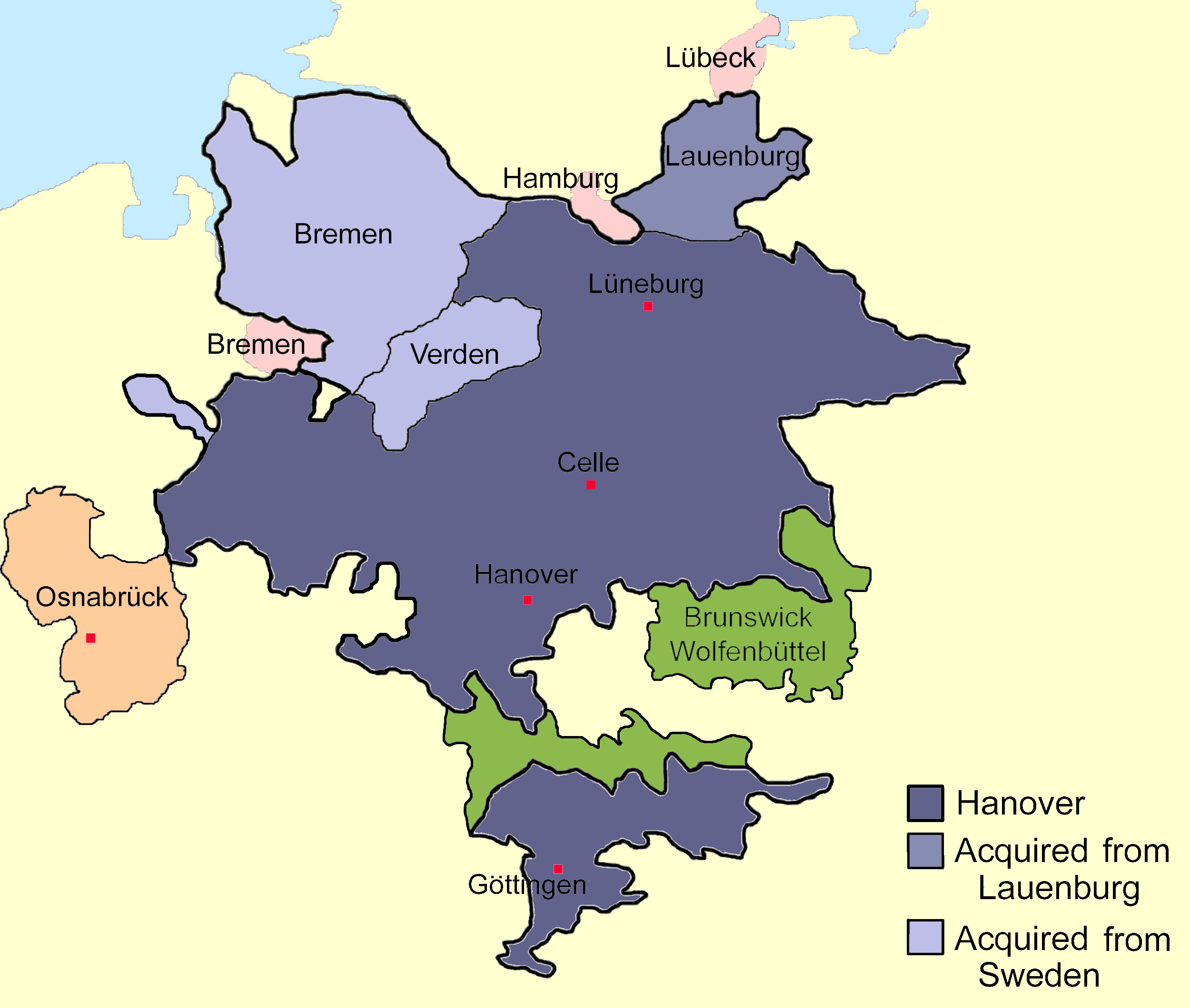
Sketch map of the state of Hanover, c.1720 showing territorial acquisitions and some neighbouring states and imperial cities; drawn in Adobe Photoshop by hand using a pen tablet.
Licens:
Public domain
Yderligere oplysninger om licens til billedet kan findes her. Sidste ændring: Wed, 29 Nov 2023 18:36:48 GMT