Great Trek map full
Forfatter/Opretter:
Attribution:
Billedet er tagget "Attribution Required", men der blev ikke angivet nogen tilskrivningsoplysninger. Attributionsparameteren blev sandsynligvis udeladt ved brug af MediaWiki-skabelonen til CC-BY-licenserne. Forfattere og ophavsmænd finder et eksempel på korrekt brug af eksempel her. her.
Kredit:
Own work using:
- Map in "The Great Trek" (1985) by B.P.J. Erasmus
- The "Illustrated History of South Africa: The Real Story" by Reader's Digest (1988), p. 115
Shortlink:
kilde:
størrelse:
4636 x 3973 Pixel (2656528 Bytes)
beskrivelse:
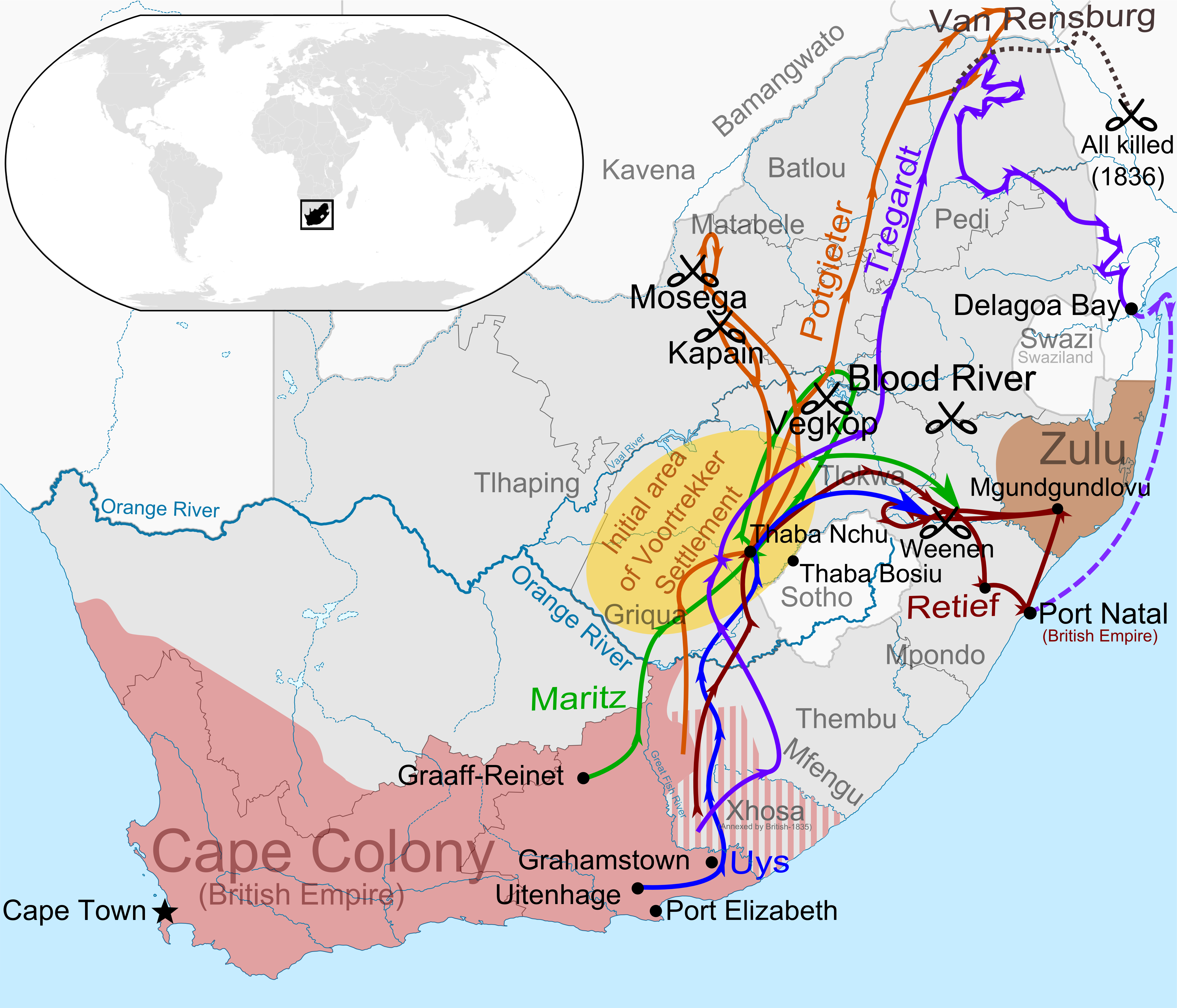
A map of the first wave of the Great Trek (1835-1840) illustrating the paths of the largest parties of Voortrekkers across Southern Africa.
Licens:
Licensbetingelser:
Creative Commons Attribution-Share Alike 4.0
Yderligere oplysninger om licens til billedet kan findes her. Sidste ændring: Fri, 26 Apr 2024 16:59:26 GMT