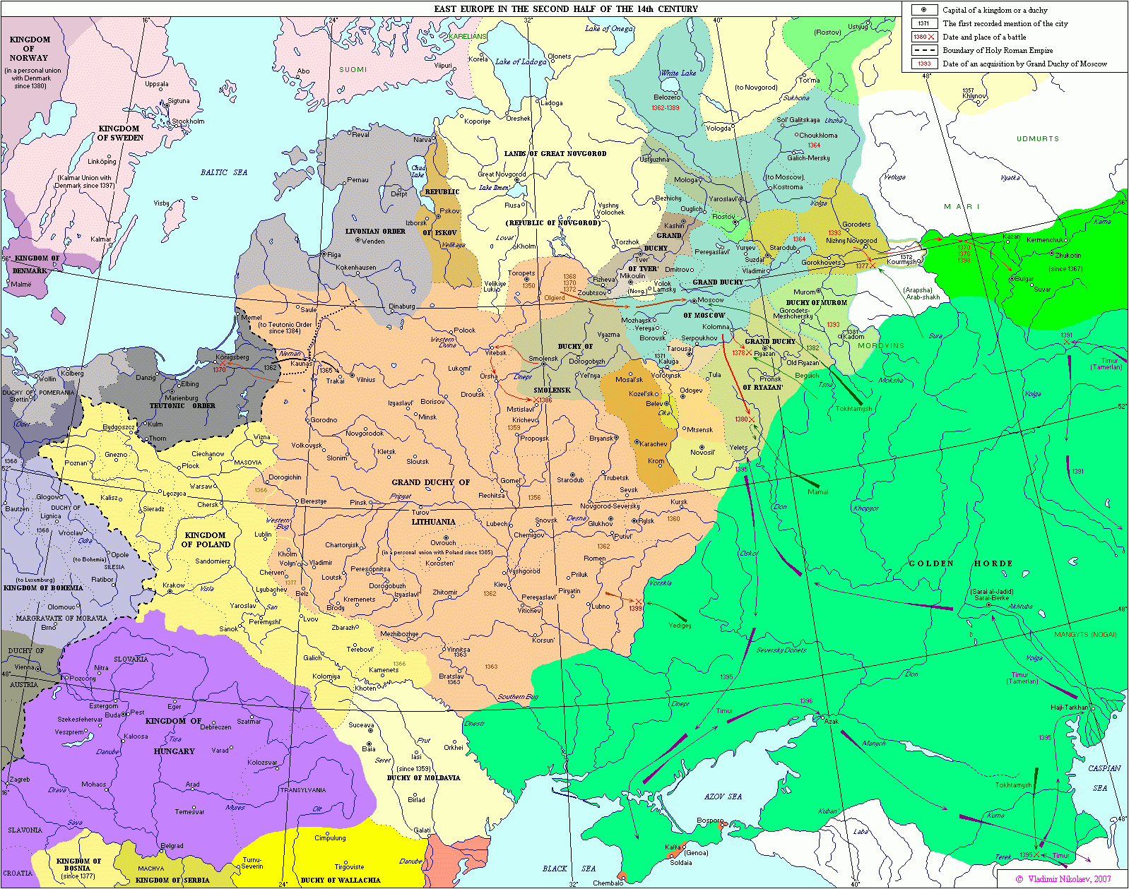
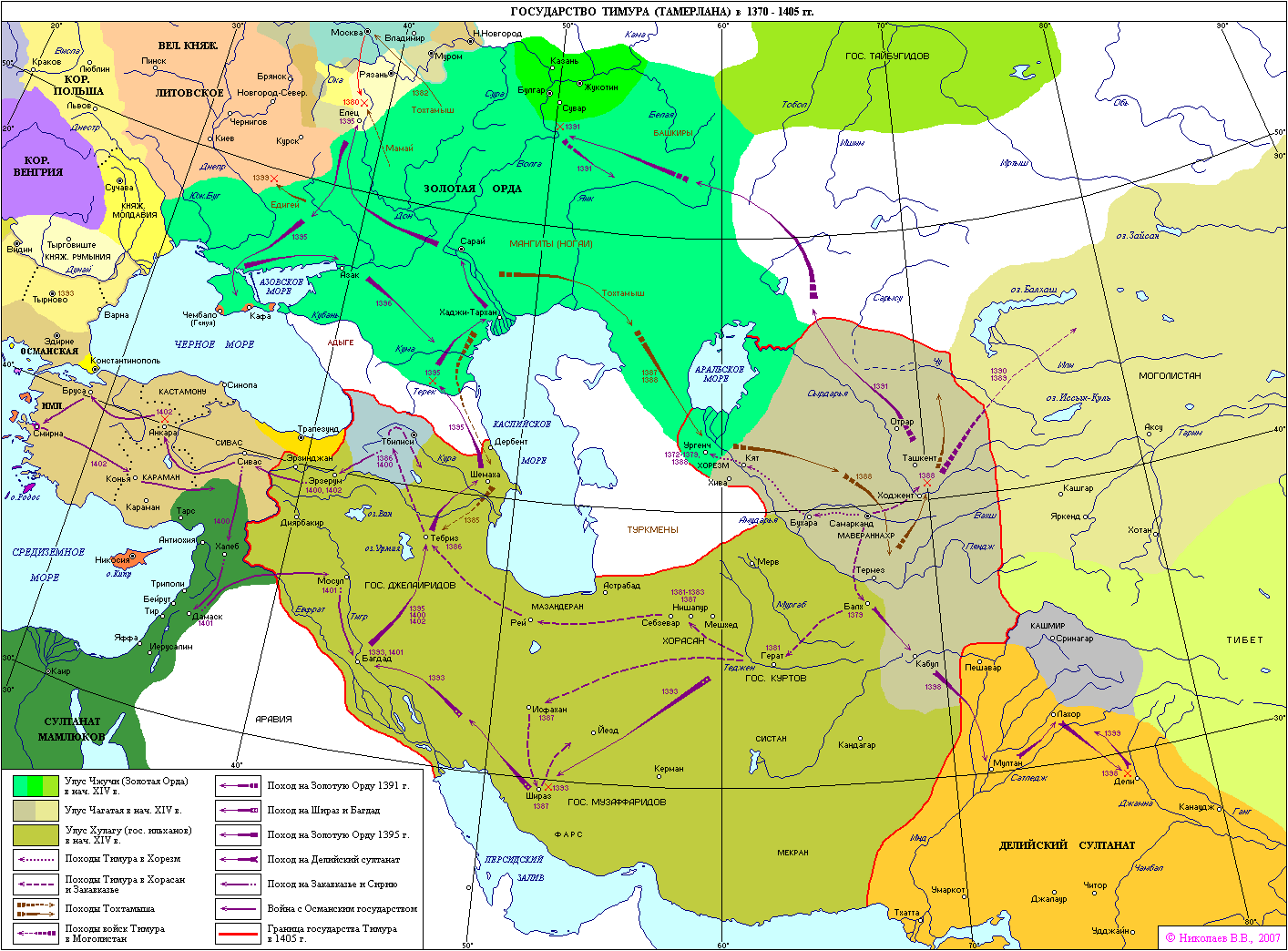
Golden Horde 1389

Forfatter/Opretter:
Attribution:
Billedet er tagget "Attribution Required", men der blev ikke angivet nogen tilskrivningsoplysninger. Attributionsparameteren blev sandsynligvis udeladt ved brug af MediaWiki-skabelonen til CC-BY-licenserne. Forfattere og ophavsmænd finder et eksempel på korrekt brug af eksempel her. her.
Kredit:
Eget arbejde. Sources used in creating this map:
- Project "Geosynchrony: Atlas of World History", western borders: Nikolaev V.V. (2007) East Europe in the second half of the XIV century; eastern borders: Nikolaev V.V. (2003) Timur's state in 1370-1405.
- Morgan, David (1986) The Mongols, Butler & Tanner, Frome, Somerset.
- This map from Shepherd, William (1911) Historical Atlas, Henry Holt and Company, New York.
- plus a review of the Tatar Encyclopedia.
Shortlink:
kilde:
størrelse:
962 x 684 Pixel (149746 Bytes)
beskrivelse:
The domains of the Golden Horde in the year 1389, before the Tokhtamysh-Timur war. The rivers are shown in blue, the 2006 international borders in light brown, and important cities of 1389 with a black circle. The capital of the Golden Horde, Sarai is shown with a gold star. Kiev, Moscow, Novgorod and Vilnius are shown as circles.
This map uses a Lambert azimuthal equal-area projection.
Licens:
Licensbetingelser:
Creative Commons Attribution-Share Alike 3.0
Yderligere oplysninger om licens til billedet kan findes her. Sidste ændring: Wed, 28 Feb 2024 12:55:36 GMT