Gettysburg Day2 Wheatfield2
Forfatter/Opretter:
Hal Jespersen
Kredit:
Eget arbejde
Shortlink:
kilde:
størrelse:
3931 x 3600 Pixel (7711427 Bytes)
beskrivelse:
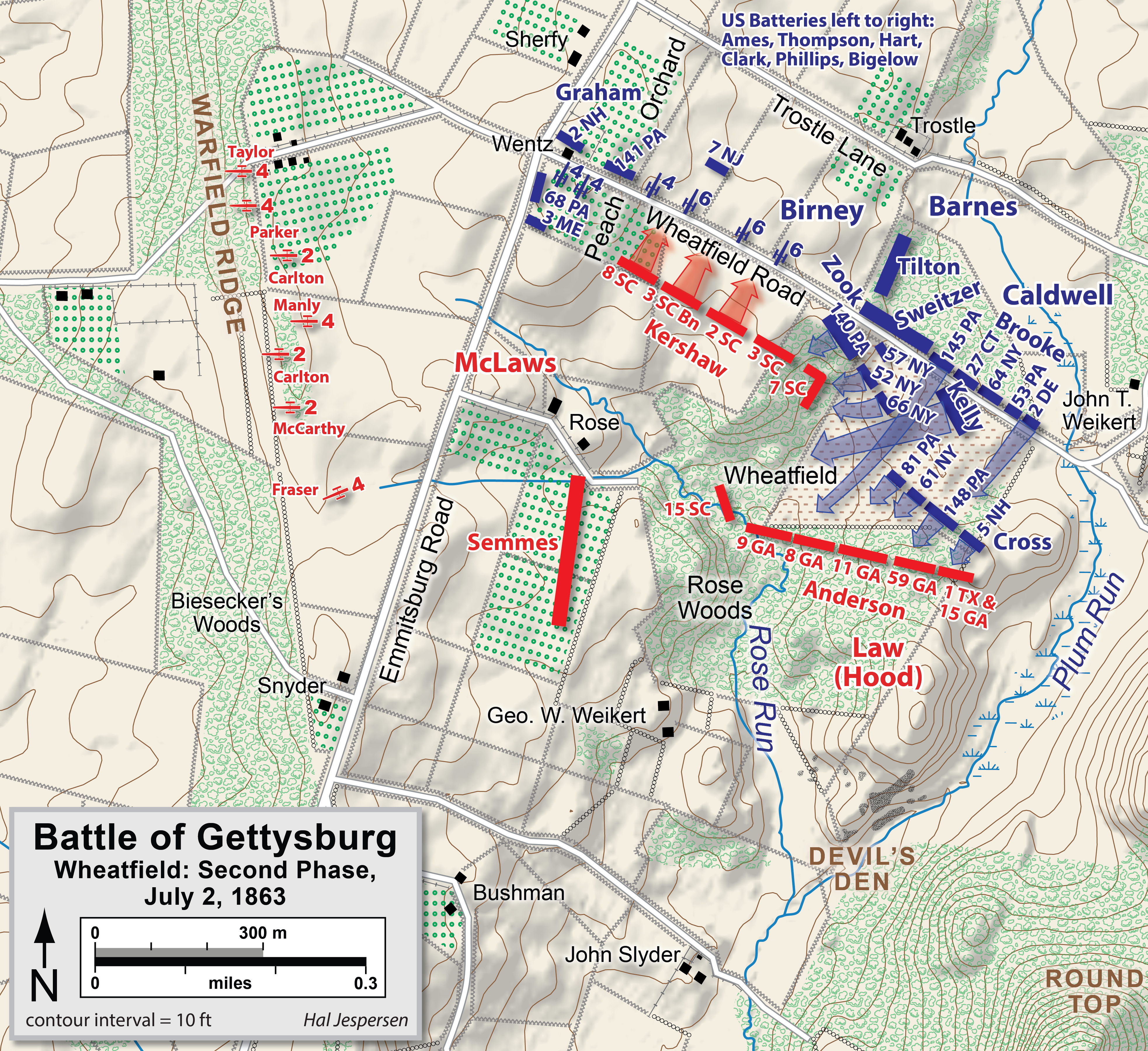
Map of Wheatfield actions in the Battle of Gettysburg, Second Day, of the American Civil War. Updated unit positions and made topographical background consistent with many other Wikipedia Gettysburg maps. Drawn in Adobe Illustrator CS5 by Hal Jespersen. Graphic source file is available at http://www.posix.com/CWmaps/
Licens:
Licensbetingelser:
Creative Commons Attribution 3.0
Yderligere oplysninger om licens til billedet kan findes her. Sidste ændring: Sun, 25 Feb 2024 13:14:28 GMT