Finland 1996 CIA map
Forfatter/Opretter:
Central Intelligence Agency, Washington, D.C., United States.
Kredit:
REPOSITORY Library of Congress Geography and Map Division Washington, D.C. 20540-4650 USA
DIGITAL ID g6960 ct001018 http://hdl.loc.gov/loc.gmd/g6960.ct001018
CALL NUMBER G6960 1996 .U6
DIGITAL ID g6960 ct001018 http://hdl.loc.gov/loc.gmd/g6960.ct001018
CALL NUMBER G6960 1996 .U6
Shortlink:
kilde:
størrelse:
1662 x 2000 Pixel (2624983 Bytes)
beskrivelse:
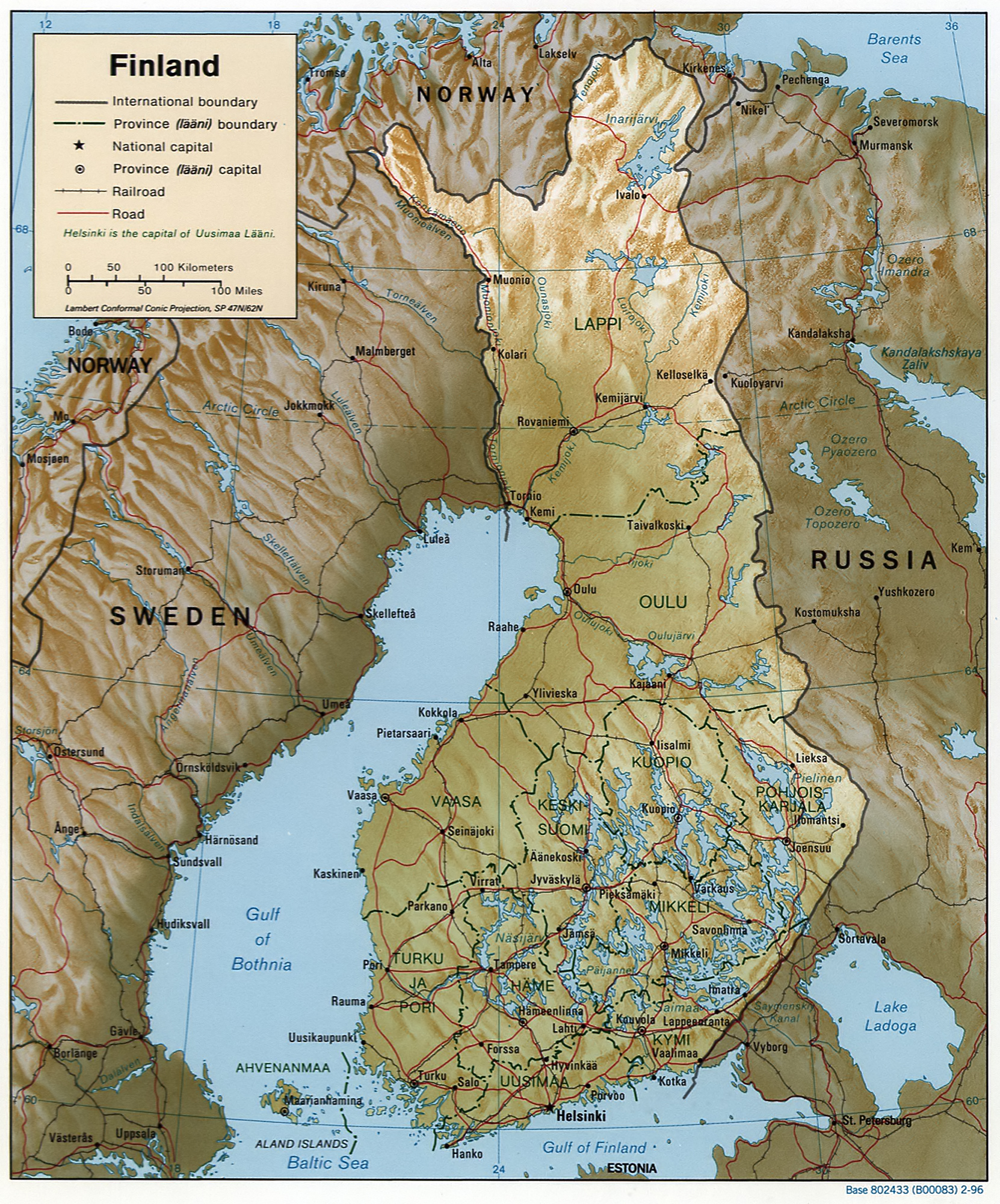
Map of Finland, relief shown by shading.
Scale [ca. 1:6,250,000]; Lambert conformal conic proj. (E 180--E 340/N 720--N 590); map 20 x 17 cm; "Base 802433 (B00083) 2-96."
Scale [ca. 1:6,250,000]; Lambert conformal conic proj. (E 180--E 340/N 720--N 590); map 20 x 17 cm; "Base 802433 (B00083) 2-96."
Licens:
Public domain
Kommentar på licensen:
| This image is a work of a Central Intelligence Agency employee, taken or made as part of that person's official duties. As a Work of the United States Government, this image or media is in the public domain in the United States.
|

|
Yderligere oplysninger om licens til billedet kan findes her. Sidste ændring: Sun, 11 Feb 2024 02:37:20 GMT