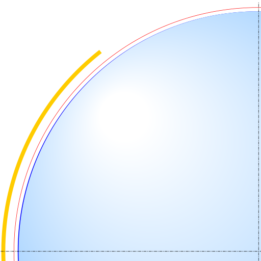
Earth oblateness to scale
Forfatter/Opretter:
Attribution:
Billedet er tagget "Attribution Required", men der blev ikke angivet nogen tilskrivningsoplysninger. Attributionsparameteren blev sandsynligvis udeladt ved brug af MediaWiki-skabelonen til CC-BY-licenserne. Forfattere og ophavsmænd finder et eksempel på korrekt brug af eksempel her. her.
Kredit:
Eget arbejde
Shortlink:
kilde:
størrelse:
512 x 512 Pixel (1956 Bytes)
beskrivelse:
Scale drawing of the oblateness of the 2003 IERS reference ellipsoid. The outer edge of the dark blue line is an ellipse with the same eccentricity as that of the Earth, with North at the top. For comparison, the outer edge of the light blue area is a circle of diameter equal to the minor axis (a point on the equator, to its antipode). The red line denotes the Karman line (100 km altitude) and the yellow area, the range of the International Space Station (330-435 km altitude, 51.65-degree orbital inclination).
Licens:
Licensbetingelser:
Creative Commons Attribution-Share Alike 3.0
Yderligere oplysninger om licens til billedet kan findes her. Sidste ændring: Fri, 12 Jan 2024 01:32:02 GMT
