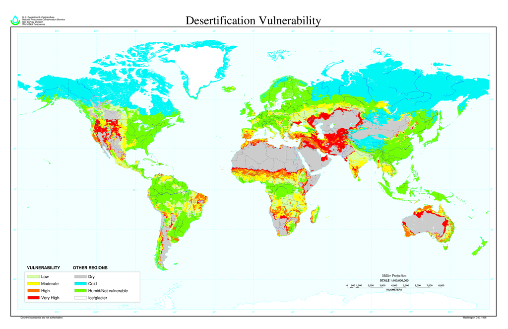
Desertification map
Forfatter/Opretter:
USDA employee
Kredit:
Shortlink:
kilde:
størrelse:
6800 x 4400 Pixel (1091317 Bytes)
beskrivelse:
Global Desertification Vulnerability Map
- About the Map: The Desertification Vulnerability map is based on a reclassification of the global soil climate map and global soil map.
- Possible Uses of the Map: Useful for teachers and students who are interested in the global distribution of desertification vulnerability. Global modelers may be able to use the data for small scale analysis.
Licens:
Public domain
Kommentar på licensen:
This image is a work of a United States Department of Agriculture employee, taken or made during the course of the person's official duties. As a work of the U.S. federal government, the image is in the public domain.
Yderligere oplysninger om licens til billedet kan findes her. Sidste ændring: Fri, 27 Jan 2023 14:45:39 GMT
