Cape Floral Region Protected Areas map
Forfatter/Opretter:
Attribution:
Billedet er tagget "Attribution Required", men der blev ikke angivet nogen tilskrivningsoplysninger. Attributionsparameteren blev sandsynligvis udeladt ved brug af MediaWiki-skabelonen til CC-BY-licenserne. Forfattere og ophavsmænd finder et eksempel på korrekt brug af eksempel her. her.
Kredit:
Map made with The GIMP and Inkscape from a public domain image out of NASA's World Wind.
Shortlink:
kilde:
størrelse:
2730 x 1116 Pixel (574085 Bytes)
beskrivelse:
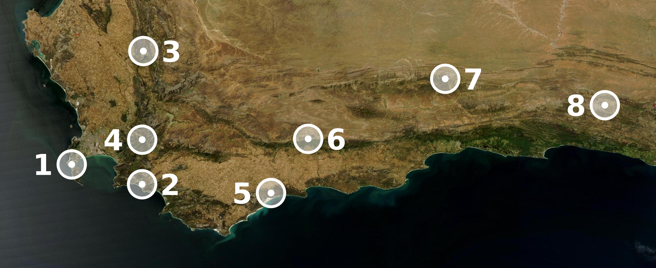
Map showing the location of the eight sites included in UNESCO's World Heritage ensemble Cape Floral Region Protected Areas, in the Cape Floristic Region of the Eastern and Western Cape, in South Africa.
- (1): Table Mountain National Park (formerly Cape Peninsula National Park)
- (2): Groot Winterhoek Wilderness Area
- (3): Cederberg Wilderness Area
- (4): Boland Mountain Complex
- (5): De Hoop Nature Reserve
- (6): Boosmansbos Nature Reserve
- (7) Swartberg Complex
- (8): Baviaanskloof Mega Reserve
Licens:
Licensbetingelser:
Creative Commons Attribution-Share Alike 3.0
Yderligere oplysninger om licens til billedet kan findes her. Sidste ændring: Mon, 14 Aug 2023 22:03:56 GMT