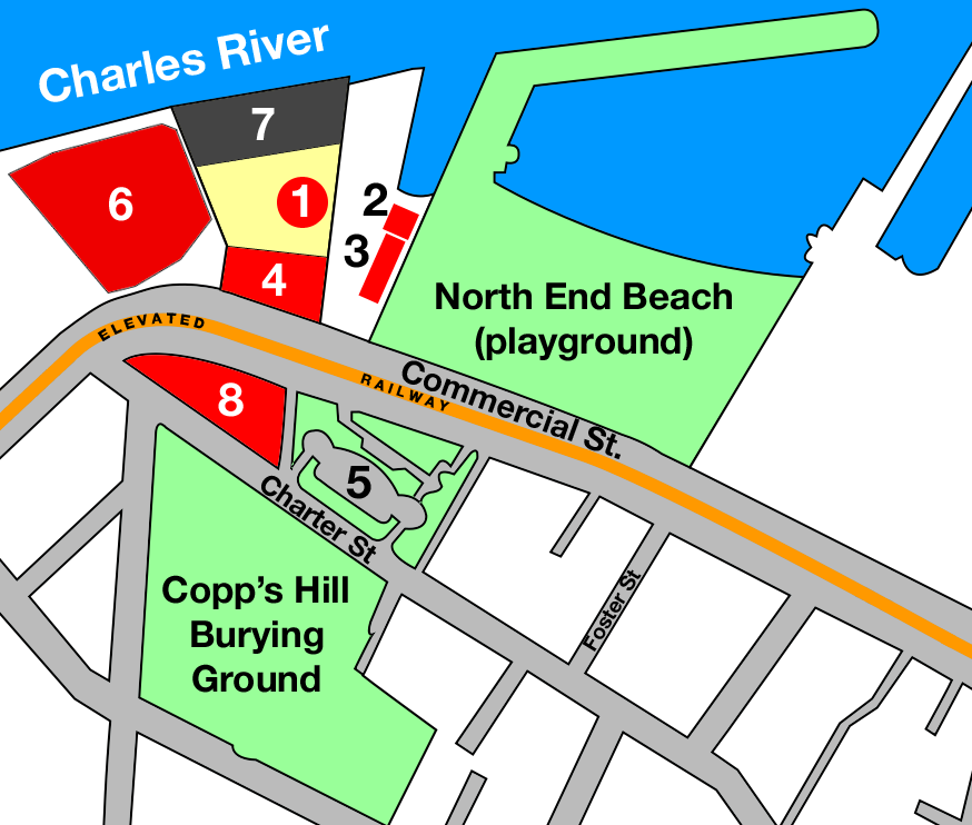
Boston molasses detail map
Forfatter/Opretter:
Kredit:
Eget arbejde
Shortlink:
kilde:
størrelse:
874 x 742 Pixel (180066 Bytes)
beskrivelse:
Map based on based on official City of Boston, Massachusetts maps published in 1895 and 1915, adding data from published accounts and deduced from photos of the Boston molasses disaster.
- Purity Distilling molasses tank
- Firehouse 31 (heavy damage)
- Paving department and police station
- Purity offices (flattened)
- Copp's Hill Terrace
- Boston Gas Light building (damaged)
- Purity warehouse (mostly intact)
- Residential area (site of flattened Clougherty house)
Licens:
Public domain
Yderligere oplysninger om licens til billedet kan findes her. Sidste ændring: Thu, 12 Oct 2023 16:24:45 GMT