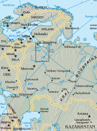
Baltic-Volga-Black-Caspian
Forfatter/Opretter:
The original uploader was Jauntymcd at engelsk Wikipedia.
Kredit:
Transferred from en.wikipedia to Commons.
Shortlink:
kilde:
størrelse:
340 x 458 Pixel (214664 Bytes)
beskrivelse:
Map of the Volga–Baltic Waterway (boxed area).
- And the entire Volga River — in relation to the Caspian Sea and Black Sea ports.
- A 19th century canal/locks system that expedited transport/shipping into/through interior western Imperial Russia to northern Europe (via Baltic) and southern Europe/West Asia (via Black Sea).
- The Soviet Union periodically modernized its components/capacities during the 20th century.
Licens:
Public domain
Yderligere oplysninger om licens til billedet kan findes her. Sidste ændring: Fri, 12 Jan 2024 03:01:49 GMT
