AxelHeibergIslandCloseupMap
Forfatter/Opretter:
Kredit:
This map's source is here, with the uploader's modifications, and the GMT homepage says that the tools are released under the GNU General Public License.
Shortlink:
kilde:
størrelse:
499 x 449 Pixel (13696 Bytes)
beskrivelse:
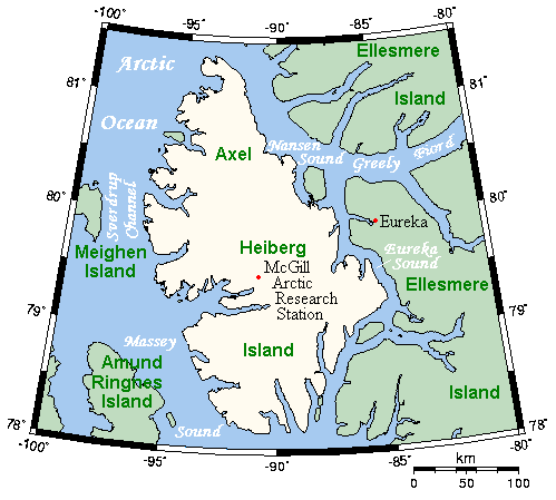
A map of Axel Heiberg Island, Nunavut, Canada, and surrounding islands and waterways.
Licens:
Licensbetingelser:
Creative Commons Attribution-Share Alike 3.0
Yderligere oplysninger om licens til billedet kan findes her. Sidste ændring: Sun, 10 Jul 2022 23:47:35 GMT