Asker Line map
Forfatter/Opretter:
Jernbaneverket / Norwegian National Rail Administration
Shortlink:
kilde:
størrelse:
898 x 575 Pixel (131903 Bytes)
beskrivelse:
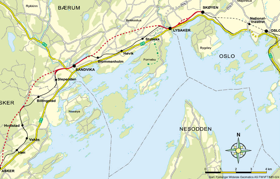
Map of the Asker Line west of Oslo, Norway. Red line is the Asker Line and black line is the Drammen Line. Dotted lines are tunnels. Black dots are stations. The green line is the Fornebu Line. The yellow lines indicate European Routes E16 and E18.
Licens:
Public domain
Kommentar på licensen:
| This file is in the public domain because legal statutes, administrative regulations, court decisions and other decisions by public authorities are unprotected. This is also the case with proposals, reports and other statements which concern the public exercise of authority, and which are made by a public authority, a publicly appointed council or committee, or published by the public authorities. Similarly, official translations of such texts are unprotected. Intellectual works ("åndsverk" as defined in § 2) which have not been produced specially for use in documents specified in the first paragraph, and from which parts are quoted or which are reproduced in a separate appendix, are not covered by this provision. The same apply to poetry, musical compositions or works of art.
|
|
Yderligere oplysninger om licens til billedet kan findes her. Sidste ændring: Thu, 11 Aug 2022 06:18:09 GMT