Arvand-Rud (Cro)

Forfatter/Opretter:
Attribution:
Billedet er tagget "Attribution Required", men der blev ikke angivet nogen tilskrivningsoplysninger. Attributionsparameteren blev sandsynligvis udeladt ved brug af MediaWiki-skabelonen til CC-BY-licenserne. Forfattere og ophavsmænd finder et eksempel på korrekt brug af eksempel her. her.
Kredit:
Own work, based on:
• Relief background from Maps For Free
• Pirouz Mojtahed-Zadeh (2006): Boundary Politics and International Boundaries of Iran, figure 10 (p. 153.)
• Encyclopædia Iranica: i. Boundaries with the Ottoman Empire by Keith McLachlan
• Encyclopædia Iranica: iv. Boundaries with Iraq + Map by Joseph A. Kechichian
• U.S. Department of State (1978): Iran-Iraq Boundary
• Perso-Croatian transliteration
Shortlink:
kilde:
.PNG?uselang=da)
størrelse:
630 x 740 Pixel (117693 Bytes)
beskrivelse:
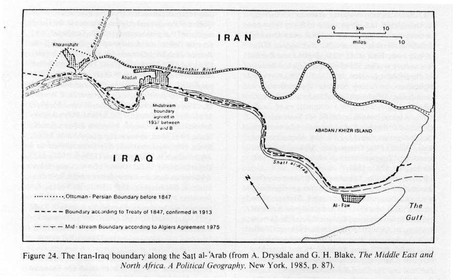
Map of the Arvand-Rud or Shatt al-Arab river — the southern border of western Iran with eastern Iraq
- with Croatian map descriptions.
Licens:
Licensbetingelser:
Creative Commons Attribution-Share Alike 3.0
Yderligere oplysninger om licens til billedet kan findes her. Sidste ændring: Sat, 18 Feb 2023 04:14:54 GMT
.PNG?uselang=de)