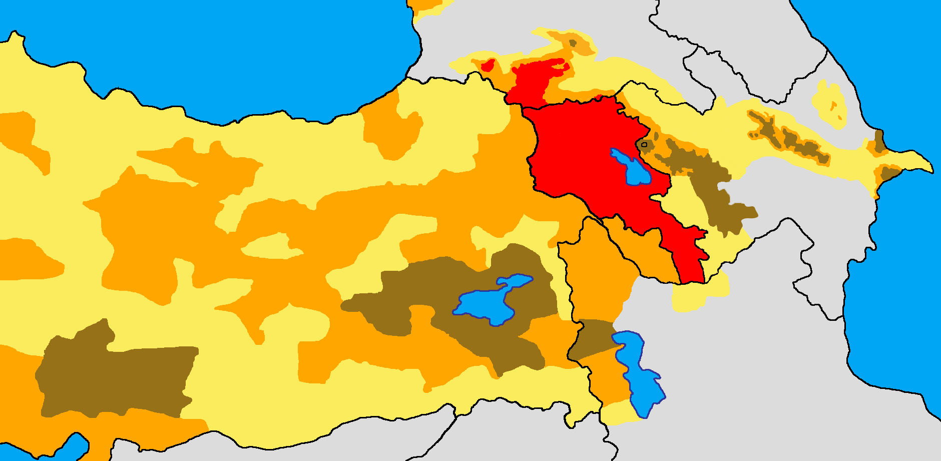
Armenian distribution map
Forfatter/Opretter:
Attribution:
Billedet er tagget "Attribution Required", men der blev ikke angivet nogen tilskrivningsoplysninger. Attributionsparameteren blev sandsynligvis udeladt ved brug af MediaWiki-skabelonen til CC-BY-licenserne. Forfattere og ophavsmænd finder et eksempel på korrekt brug af eksempel her. her.
Kredit:
Eget arbejde
Shortlink:
kilde:
størrelse:
1880 x 921 Pixel (91517 Bytes)
beskrivelse:
Historical and modern distribution of Armenians.
Settlement areas of Armenians in early 21st century.
Settlement areas of Armenians in early 20th century. More than 50%
25-50%
Less than 25%
Works used:
- (in Armenian) Yerevan State University Institute for Armenian Studies: Արևմտահայությունը XIXդ. 70-ական թթ. (էթնիկ քարտեզ) (Western Armenians in 1870s (ethnic map))
- (in Russian) А. Цуциев (A. Tsutseyev), Атлас Этнополитической Истории Кавказа (Atlas of the Ethno-political history of the Caucasus), "Yevropa" Publishing House, Moscow, 2007: 1886–1890: Этнолингвистическая карта Кавказа (1886-1890: Ethno-linguistic map of the Caucasus)
- European Centre for Minority Issues, Ethnic Map of Georgia; January 2009
- (in Russian) Армяне накануне геноцида. Нач. XX века. (Armenians on the eve of genocide. Early 20th century.)
- (in Russian) Карапетян Сергей Арменакович Арцах, Гардман, Нахиджеван - триединая формула территориальной целостности Восточной Армении Ереван 2008.
.jpg)
Licens:
Licensbetingelser:
Creative Commons Attribution-Share Alike 3.0
Yderligere oplysninger om licens til billedet kan findes her. Sidste ændring: Wed, 04 Oct 2023 20:12:16 GMT