Apachean present
Forfatter/Opretter:
Attribution:
Billedet er tagget "Attribution Required", men der blev ikke angivet nogen tilskrivningsoplysninger. Attributionsparameteren blev sandsynligvis udeladt ved brug af MediaWiki-skabelonen til CC-BY-licenserne. Forfattere og ophavsmænd finder et eksempel på korrekt brug af eksempel her. her.
Kredit:
- Bureau of Indian Affairs. (n.d.). Indian Reservations in the Continental United States [Map]. Retreived November 10, 2006, from http://www.cr.nps.gov/nagpra/DOCUMENTS/ResMAP.HTM.
- Ortiz, Alfonso (Ed.). (1983). Handbook of North American Indians: Southwest (Vol. 10). Washingon, D.C.: Smithsonian Institution.
- Mithun, Marianne. (1999). The languages of Native North America. Cambridge: Cambridge University Press.
- U.S. Census Bureau. (2000). American Indians and Native Alaskans in the United States [Map]. Retreived November 10, 2006, from http://www2.census.gov/geo/maps/special/aian_wall/aia_us_100.gif.
Shortlink:
kilde:
størrelse:
1173 x 574 Pixel (111149 Bytes)
beskrivelse:
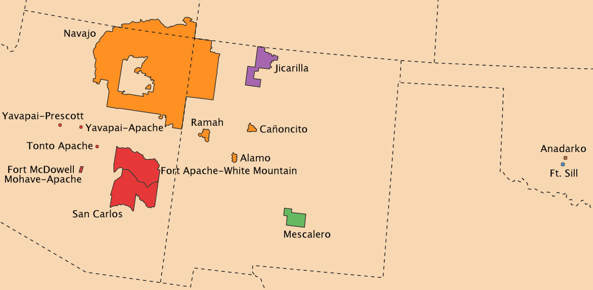
The present-day primary locations of Apachean peoples (including reservations and cities)
- Note that here Navajo is included as Apachean.
- Other Apachean peoples are dispersed throughout the continent. In particular, there are Lipan in Texas and a large number of Navajos in New York City.
- Color indicates association:
 * Red map regions - Western Apache (Apacheeg ar c'hornôg) Tonto, Coyotero
 * Orange map regions - Navajo
 * Blue map regions - Chiricahua, Ndendahe, Mimbreño
 * Green map regions - Mescalero
 * Purple map regions - Jicarilla
 * Yellow map regions - Lipan (Lipek)
* Brown map regions - Plains Apache (Kataka c.d. "Kiowa Apache", Apacheeg ar c'hompezennoù)
Licens:
Kommentar på licensen:
Du kan vælge den licens du foretrækker.
Licensbetingelser:
Creative Commons Attribution-Share Alike 3.0
Yderligere oplysninger om licens til billedet kan findes her. Sidste ændring: Fri, 19 Apr 2024 15:07:18 GMT