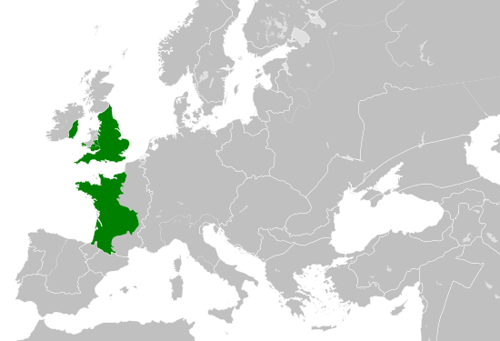
Angevin Empire 1190
Forfatter/Opretter:
- Blank map of Europe.svg: maix
- derivative work: Alphathon
Attribution:
Billedet er tagget "Attribution Required", men der blev ikke angivet nogen tilskrivningsoplysninger. Attributionsparameteren blev sandsynligvis udeladt ved brug af MediaWiki-skabelonen til CC-BY-licenserne. Forfattere og ophavsmænd finder et eksempel på korrekt brug af eksempel her. her.
Kredit:
This file was derived from: Blank map of Europe.svg: ![]()
Primary data source:
Shortlink:
kilde:
størrelse:
550 x 375 Pixel (1022039 Bytes)
beskrivelse:
A map of the so-called Angevin Empire within Europe circa 1190 CE, including possessions/vassals in France, Marcher Lordships in Wales and Barons in Ireland.
Note that the borders of the Cumans, Kipchaks, Kievan Rus', Kama Bulgarians and Viatka do not extend right to the edge of the map (due to a sub-map covering them up on the source map).
Also, Ireland was not united but was in fact composed of many petty kingdoms with a weak over-king.
Licens:
Licensbetingelser:
Creative Commons Attribution-Share Alike 4.0
Yderligere oplysninger om licens til billedet kan findes her. Sidste ændring: Mon, 22 Apr 2024 22:19:08 GMT
