AmsterdamIsl Map
Forfatter/Opretter:
Kredit:
Original drawing
Shortlink:
kilde:
størrelse:
1887 x 2112 Pixel (749208 Bytes)
beskrivelse:
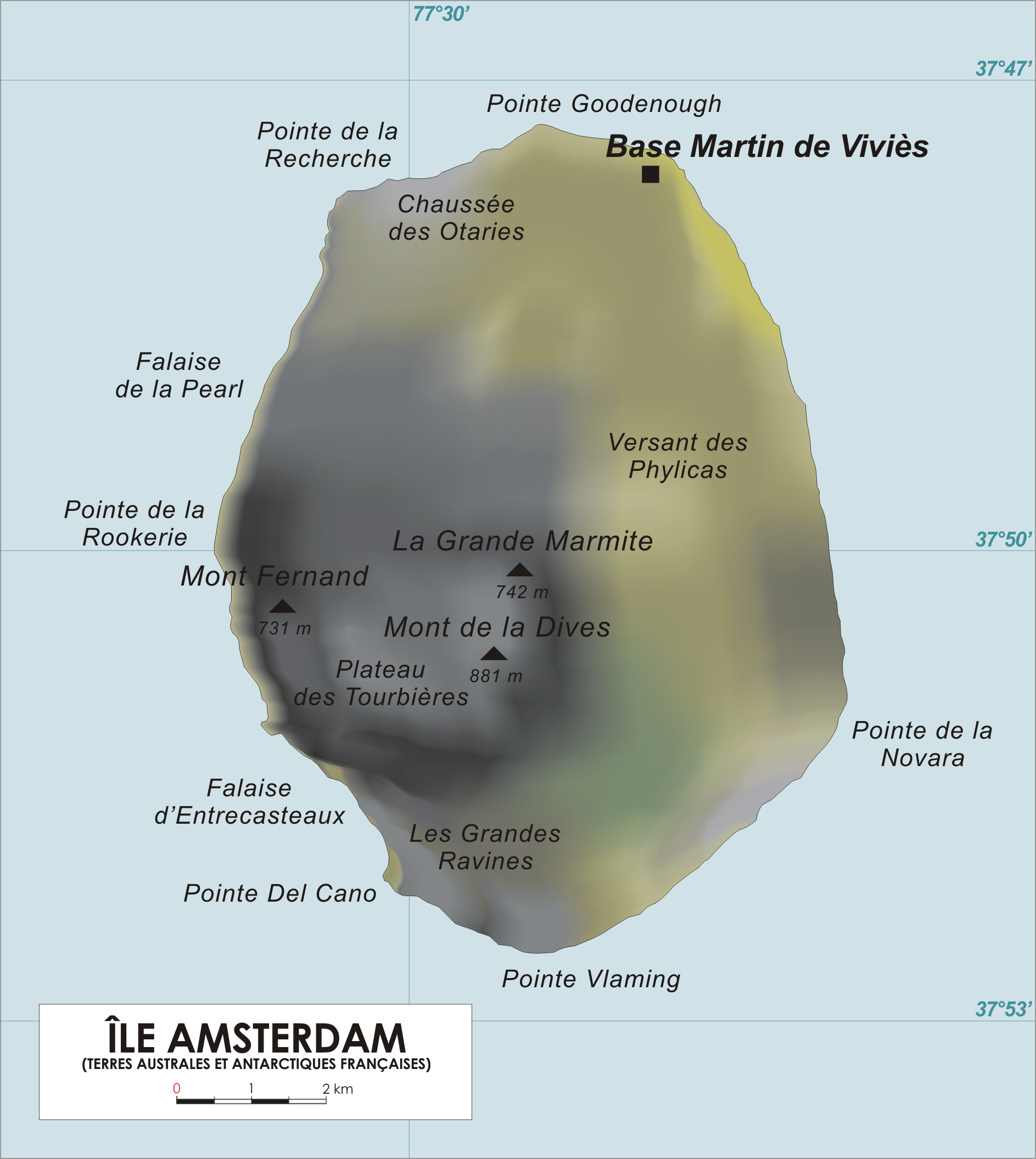
Map of Amsterdam Island, French Southern and Antarctic Territories.
Licens:
Public domain
Yderligere oplysninger om licens til billedet kan findes her. Sidste ændring: Wed, 21 Apr 2021 15:08:41 GMT