Alemannic-Dialects-Map-English
Forfatter/Opretter:
- Alemannic-Dialects-Map-English.svg: *Alemannic-Dialects-Map-German.svg: *Alemannic_language_location_map_in_1950-de.svg: *derivative work: Pyrokrat (talk)
- Alemannic_language_location_map_in_1950-fr.svg: Sémhur
- derivative work: Testtube (talk)
- derivative work: Testtube (talk)
Attribution:
Billedet er tagget "Attribution Required", men der blev ikke angivet nogen tilskrivningsoplysninger. Attributionsparameteren blev sandsynligvis udeladt ved brug af MediaWiki-skabelonen til CC-BY-licenserne. Forfattere og ophavsmænd finder et eksempel på korrekt brug af eksempel her. her.
Shortlink:
kilde:
størrelse:
1400 x 1000 Pixel (858416 Bytes)
beskrivelse:
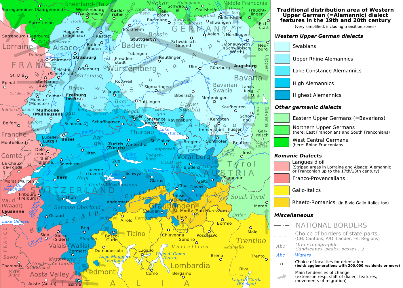
The traditional distribution area of the western upper German (=alemannic) dialects in the 19th and 20th century. Source: Mainly these articles in the German wikipedia: * Alemannische Dialekte * Grenzorte des alemannischen Dialektraums * Traditionell rätoromanischsprachiges Gebiet Graubündens and * Sprachen und Dialekte in der Region Elsass, plus the (newer) literature, which is mentioned there. This area, having been quite stable for at least some 300 years up to the 19th century, saw consecutively more or less strong changes by industrialisation, population growth, migrations and political developments.
Licens:
Licensbetingelser:
Creative Commons Attribution-Share Alike 3.0
Yderligere oplysninger om licens til billedet kan findes her. Sidste ændring: Fri, 22 Jul 2022 19:39:49 GMT