Virgin Islands-map-CIA

Forfatter/Opretter:
CIA
Kredit:
University of Texas Libraries, Perry-Castañeda Library Map Collection: Americas Maps
Shortlink:
kilde:
størrelse:
1036 x 1525 Pixel (141799 Bytes)
beskrivelse:
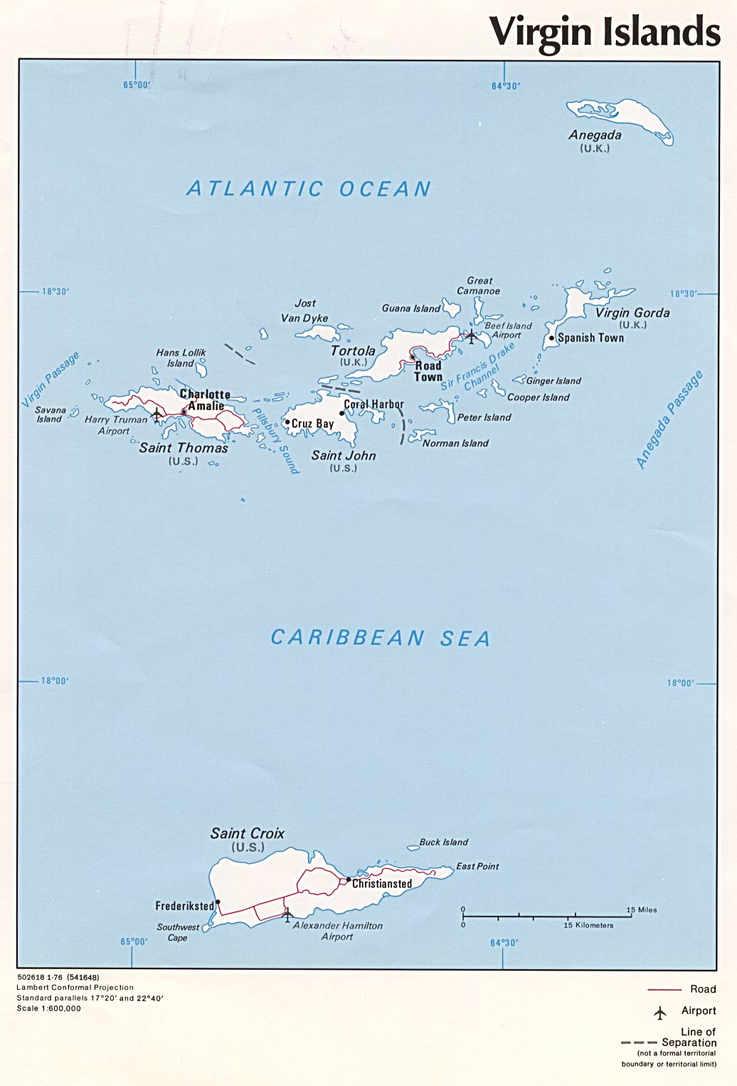
Political map of U.S. Virgin Islands and British Virgin Islands, 1976, produced by the U.S. Central Intelligence Agency.
Licens:
Public domain
Yderligere oplysninger om licens til billedet kan findes her. Sidste ændring: Sat, 13 Apr 2024 03:50:24 GMT