USA Territorial Growth small
Forfatter/Opretter:
- Original: United States Geological Survey (USGS)
- Derivative work: Roke~commonswiki
Kredit:
- United States Geological Survey (USGS)
- Eget arbejde. Images put together in Corel Painter IX.
Shortlink:
kilde:
størrelse:
431 x 287 Pixel (467111 Bytes)
beskrivelse:
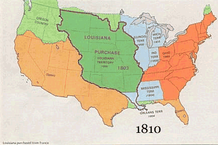
US territorial growth 1810–1920, based on the PD USGS maps in Category:Territorial growth maps of the United States.
See key below for explanation of colors.
See key below for explanation of colors.
Licens:
Public domain
Yderligere oplysninger om licens til billedet kan findes her. Sidste ændring: Fri, 23 Feb 2024 19:44:08 GMT