Sunda strait map v3
Forfatter/Opretter:
Kredit:
Combination of CIA World Factbook map and Demis Map Server (http://www2.demis.nl/mapserver/mapper.asp) data with additional annotations and modifications by self.
Shortlink:
kilde:
størrelse:
489 x 600 Pixel (317685 Bytes)
beskrivelse:
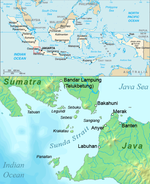
Map of the Sunda Strait, Indonesia.
Licens:
Public domain
Kommentar på licensen:
This image is in the public domain because it came from the site https://www.demis.nl/products/web-map-server/examples/ and was released by the copyright holder. Permission is granted to copy, distribute and/or modify this map since it is based on free of copyright images from: www.demis.nl. See also approval email on de.wp and its clarification.
Yderligere oplysninger om licens til billedet kan findes her. Sidste ændring: Tue, 02 Apr 2024 15:53:15 GMT