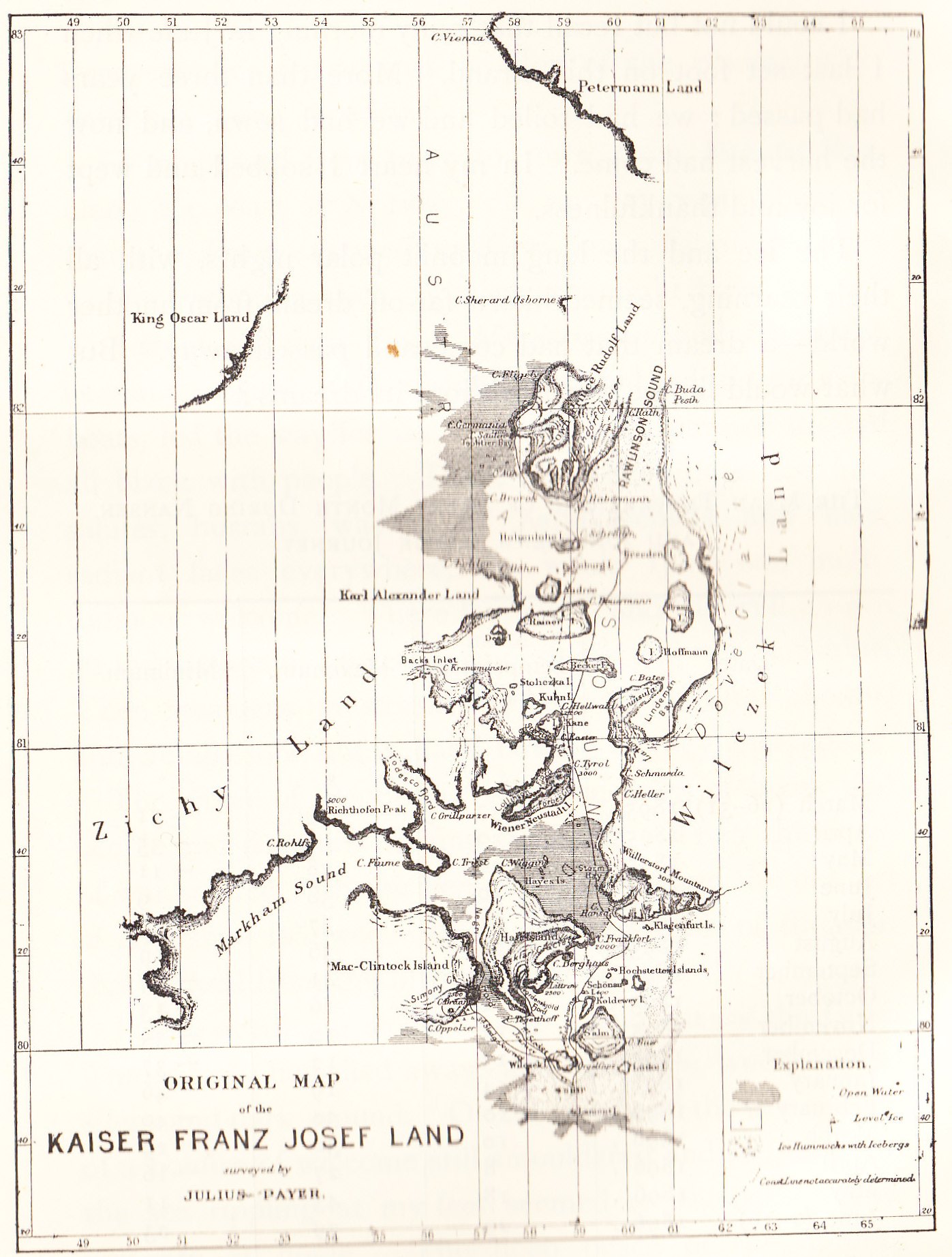
Payer map Franz Josef Land 1874
Forfatter/Opretter:
Julius Payer 1841-1914
Kredit:
Nansen, Fridtjof: Farthest North, Vol II, Constable & Co, London 1897
Shortlink:
kilde:
størrelse:
1397 x 1844 Pixel (423346 Bytes)
beskrivelse:
Old map of the Franz Josef Land archipelago drawn by the land's discoverer, Julius Payer
Licens:
Public domain
Yderligere oplysninger om licens til billedet kan findes her. Sidste ændring: Sat, 06 Apr 2024 20:55:05 GMT