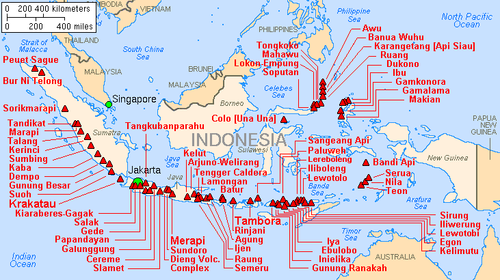
Map indonesia volcanoes
Forfatter/Opretter:
Lyn Topinka, USGS; base map from CIA, 1997; volcanoes from Simkin and Siebert, 1994
Kredit:
Shortlink:
kilde:
størrelse:
731 x 410 Pixel (25567 Bytes)
beskrivelse:
Major volcanoes of Indonesia, with eruptions since 1900 AD
Licens:
Public domain
Kommentar på licensen:
This image is in the public domain in the United States because it only contains materials that originally came from the United States Geological Survey, an agency of the United States Department of the Interior. For more information, see the official USGS copyright policy.
Yderligere oplysninger om licens til billedet kan findes her. Sidste ændring: Tue, 02 Apr 2024 15:53:26 GMT