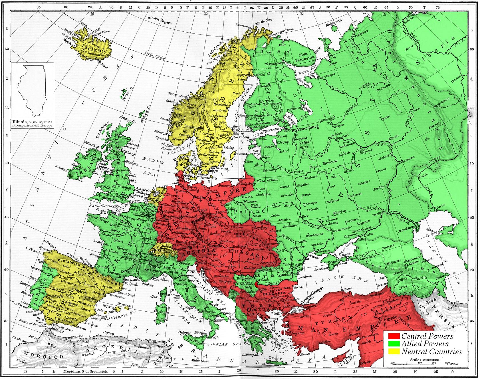
Map 1914 WWI Alliances
Forfatter/Opretter:
No machine-readable author provided. Knutux assumed (based on copyright claims).
Kredit:
No machine-readable source provided. Own work assumed (based on copyright claims).
Shortlink:
kilde:
størrelse:
1682 x 1328 Pixel (630226 Bytes)
beskrivelse:
Map of Europe's alliances in 1915. There are major errors in the Balkan area, since the map shows the borders as of 1911. After the Balkan Wars the borders changed significantly.
I, Carnildo, c
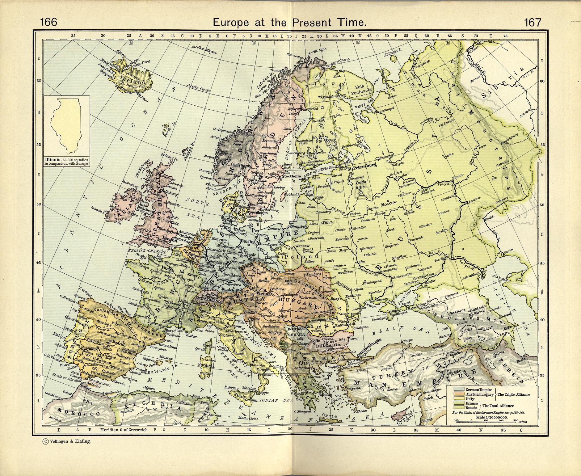
reated this map from a map from William Shepard's 1911 Historical Atlas. The original map was downloaded from the University of Texas' Perry-Castañeda Library map collection, URL http://www.lib.utexas.edu/maps/historical/shepherd_1911/shepherd-c-166-167.jpg.
Licens:
Public domain
Yderligere oplysninger om licens til billedet kan findes her. Sidste ændring: Wed, 19 Apr 2023 16:43:46 GMT