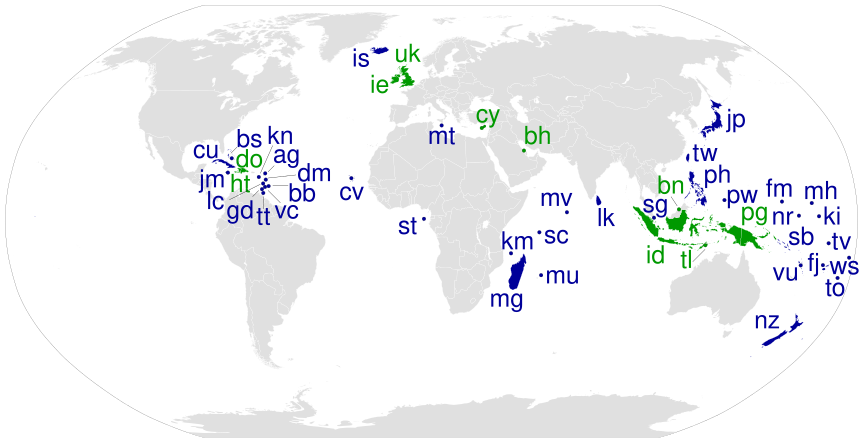
Island nations
Forfatter/Opretter:
cmglee, Canuckguy and many others
Kredit:
Shortlink:
kilde:
størrelse:
863 x 443 Pixel (1623776 Bytes)
beskrivelse:
World Map showing island countries which are sovereign states and states with limited recognition, as listed on http://en.wikipedia.org/wiki/List_of_island_countries on 18 Dec 2015. Those with land borders with other states are shaded green, and those without are shaded dark blue.[1]
Licens:
Public domain
Yderligere oplysninger om licens til billedet kan findes her. Sidste ændring: Thu, 25 Apr 2024 04:09:40 GMT

