Han map
Forfatter/Opretter:
User Yuninjie on en.wikipedia
Attribution:
Billedet er tagget "Attribution Required", men der blev ikke angivet nogen tilskrivningsoplysninger. Attributionsparameteren blev sandsynligvis udeladt ved brug af MediaWiki-skabelonen til CC-BY-licenserne. Forfattere og ophavsmænd finder et eksempel på korrekt brug af eksempel her. her.
Kredit:
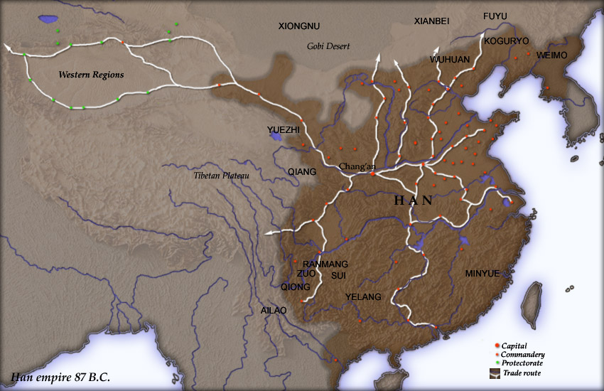
Created and copyright (2004) by Yuninjie. Released under the GNU FDL. The northern border is the line of the en:Qin Dynasty en:Great Wall. Trade routes are generally based on the work of en:Joseph Needham. Selected non-Chinese peoples are also shown.
Shortlink:
kilde:
størrelse:
850 x 550 Pixel (154737 Bytes)
beskrivelse:
Map of en:Han Dynasty empire 87 BC, showing the capital en:Chang'an and the location of all en:commandery seats. In the Western Regions, a number of pretectorates were Han vassals and under the nominal authority of the Chief Protector of the Western Regions appointed by the Han court.
en:Category:Maps of the history of China
Licens:
Kommentar på licensen:
Released under the GNU Free Documentation License.
Licensbetingelser:
Creative Commons Attribution-Share Alike 3.0
Yderligere oplysninger om licens til billedet kan findes her. Sidste ændring: Thu, 28 Dec 2023 16:22:31 GMT